Geological Maps - What They Are and How to Use Them to Find Gold
Why is it necessary to know what Geological maps show you?
Topographical Maps show you where you are in relation to a locality, feature or road. Basic topography is also included but in much less detail on Geologic Maps.
However, Geologic Maps show you the specific rock units and geological structures where you can target gold and other Minerals in an area.
Geological Map 1:250000 Cue
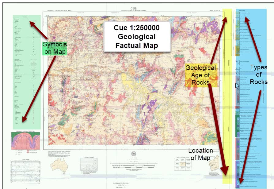 1:250000 Factual Geological Map Cue
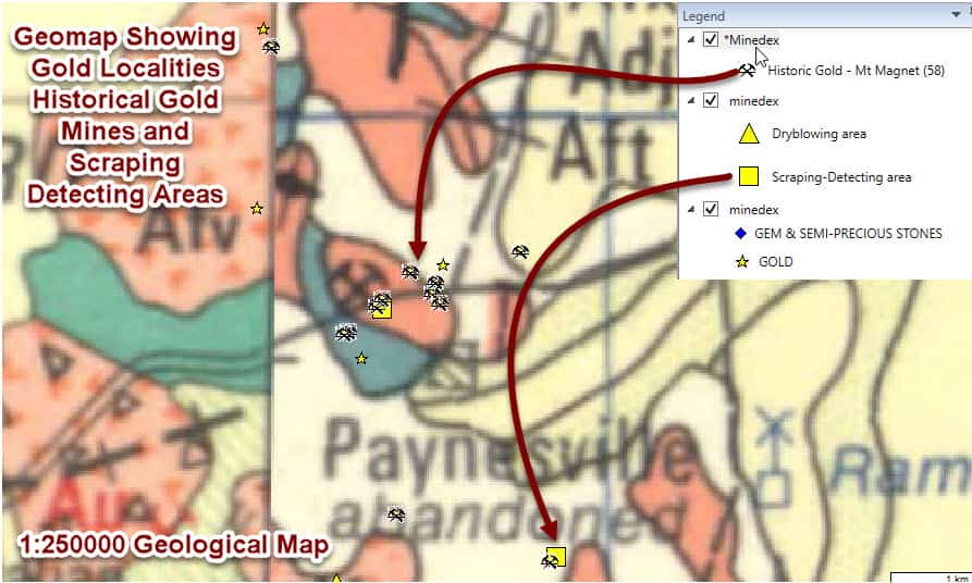
Geological Maps also show you where minerals such as gold have been found in the past.
This helps you understand the geology where gold occurs in the area of the map.
Geological Maps A Brief Overview
Geological maps are special-purpose maps made to show geological features.
Rock units or geologic strata are shown by color or symbols to indicate where they are exposed at the surface.
Bedding planes and structural features such as faults, folds, foliations, and lineation are shown with strike and dip or trend and plunge symbols which give these features' three-dimensional orientations.
GEOLOGY is the science and study of the physical matter that constitutes the Earth.
The field of geology encompasses the study of the composition, structure, properties, and history of the planet's physical material, and the processes by which it is formed, moved, and changed.
Definition provided by Wikepedia - Definition
Sedimentary Rock Structures Cover Most of the Earths Surface
Sedimentary rock structures cover around 75% of the earths surface.
Factual geological maps in WA show what rocks and sediments are outcropping at the surface. Like the 1:250000 Map shown above
The sediments at the surface hide the bedrock structures and rocks below.
To understand the structure underneath the surface you need geological maps such as the 1:500000 Interpreted Bedrock Geology Maps.
Then you can understand the geological structures and rock types underneath and this is crucial to know when you are prospecting for gold at the surface.
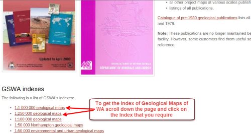
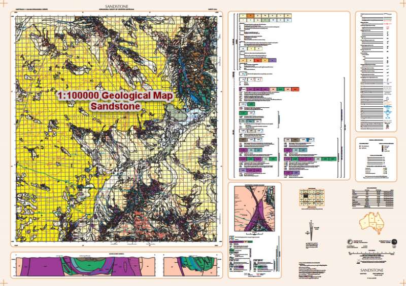
We have built a few pages to help you understand the different types of Geological Maps, how to access free Geological maps and use them as gold maps to target gold. See the links below.
1:500000 Interpreted Bedrock Geology Map
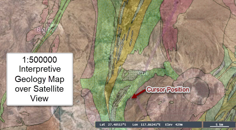 1:500000 Interpretive Geology Map Over Satellite View
Standard Colours and Symbols Used In Australia For Maps
Colours of rocks - Although there is a data standard for rock and strata based on type of rock and geological age of the rock, due to the complexity of mapping needs it is essential you refer to each Map Key or Legend to understand the type of rock and its geological age in the area you want to prospect.
Download the Standard Mapping Colours or Symbols Used from this site if you are interested in them.
Note that the site states the following;
"In the 1980s, Geoscience Australia's predecessor, the Bureau of Mineral Resources (BMR), published an Australian standard colour scheme for geological maps. However, the increasing complexity of geological maps published in recent years has meant that maintaining a single colour scheme for all geological maps is no longer practical. The BMR colour scheme may, however, be applied to some geological maps as a rough guide."
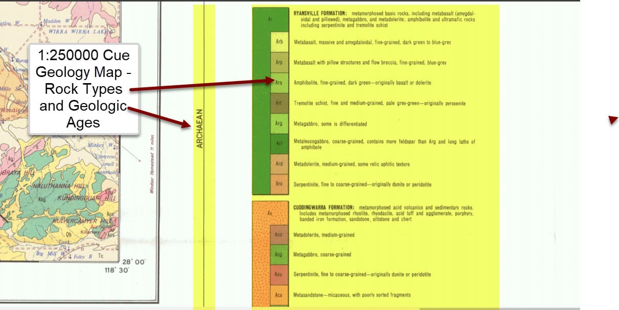
Ages of Rocks and Rock Types
Ages of Rocks and Rocks type are important when you are looking for gold and minerals in a locality. These are shown on the legends of Geological Maps. The rock types abbreviations are are show by the Geological Age first eg "A" Archaen then details of the rock type abbreviated for example
Aba "A" = Archaen, "ba" = Metamorphosed mafic agglomerate - Amphibolite.
Geological Maps - Symbols Legend
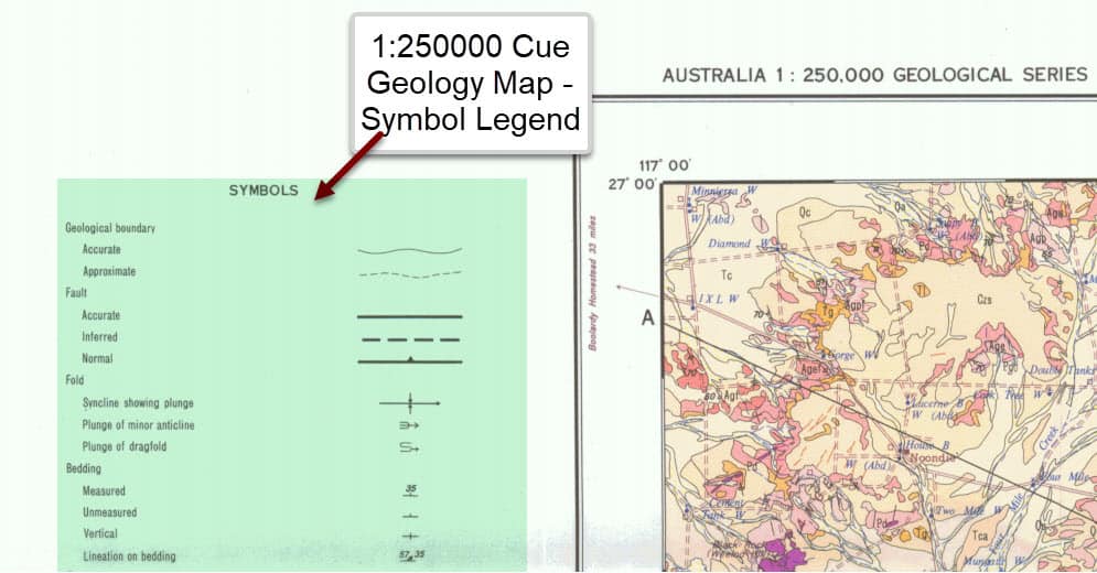
The Maps also contain a Legend area to show you the symbols on the Map and what they mean.
The legend also includes information where mines or abandoned mines have been located and the types of minerals being mined, so you can reference them on the map.
Cross Sections On Geological Maps
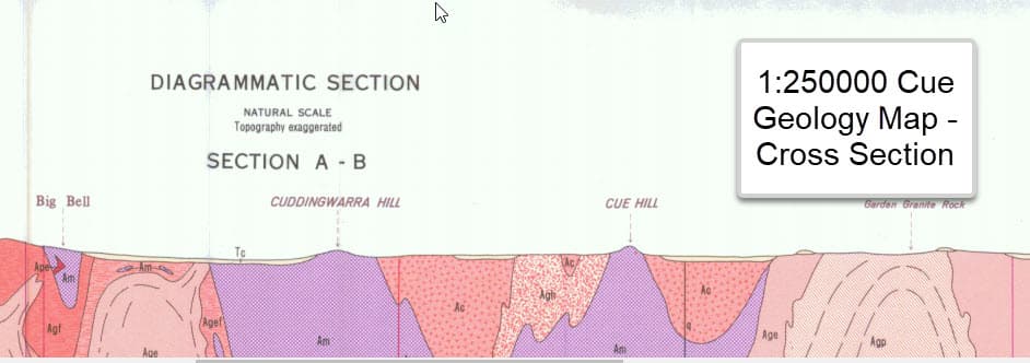 1:250k Geological Map Cue cross section
Geological Maps may also contain a cross section are showing the topography and indicated geology below the surface.
Further Reading on Geological Maps
We have created a few pages on geological maps which show;
- The types of Geological maps available.
- Where you can get copies for Free.
- How to use Geological Maps as Gold Maps to identify where you might find gold.
Return to Gold Prospecting home Page from Geological Maps page
![[Most Recent Gold Price Quotes in Australian $]](https://www.kitconet.com/charts/metals/gold/t24_au_en_auoz_2.gif)
![[Most Recent Gold Price Quotes in US $]](https://www.kitconet.com/charts/metals/gold/t24_au_en_usoz_2.gif)